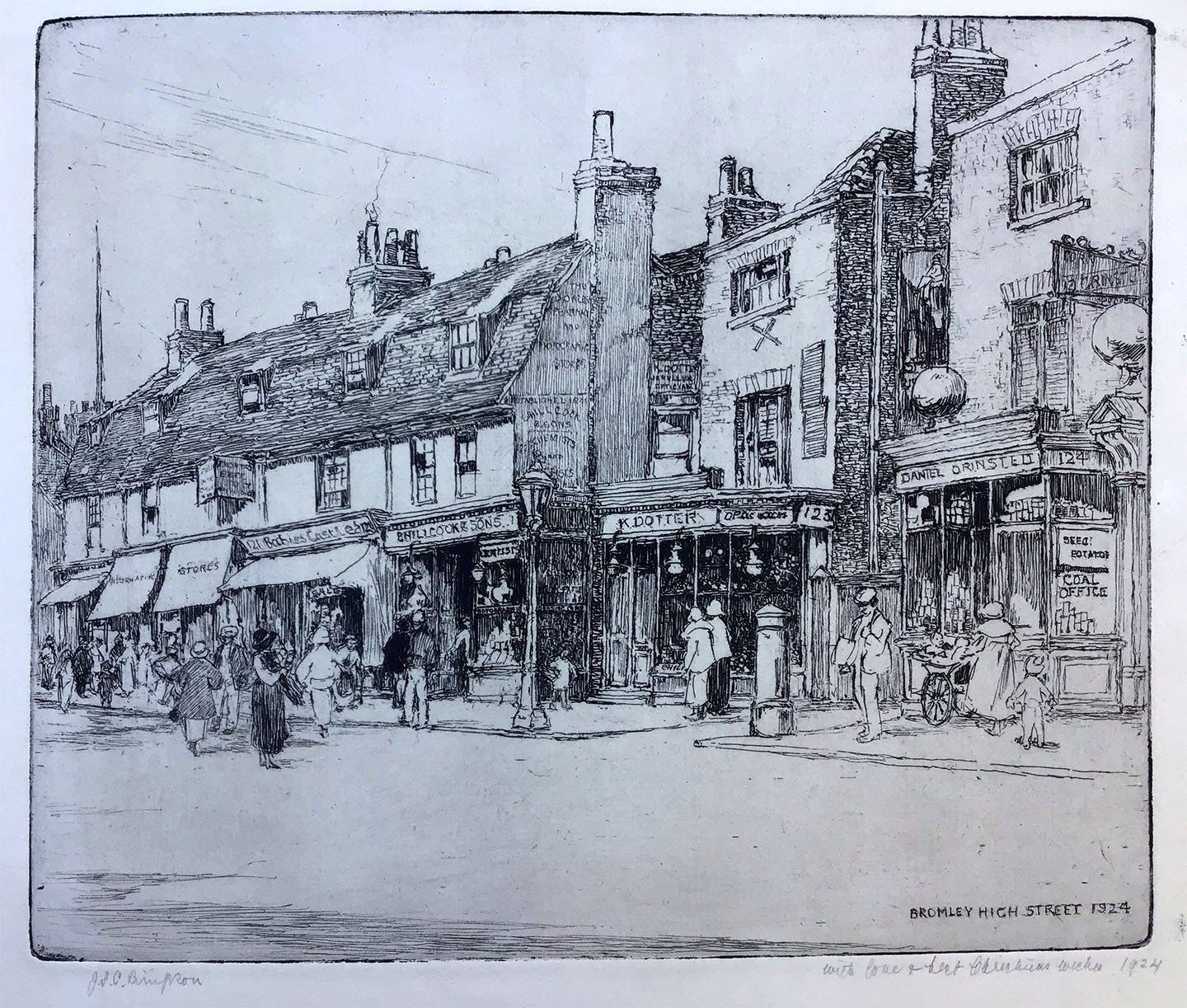
Janet Scott Chisholm Simpson was born in March 1874, the fourth of six children, to David Goudie Simpson and Janet Scott Simpson, nee Chisholm. She spent her early life in south London and trained at Lambeth School of Art and the Royal College of Art where she won both Bronze and Sliver medals. She exhibited her work between 1904 and 1938 at most major societies and galleries in England including Abbey Gallerie 54 times, Grosvenor once, Walker Liverpool 19, Royal Academy 29, Royal Society of Painters and Etchers 49 and at the Royal Scottish Academy seven times.
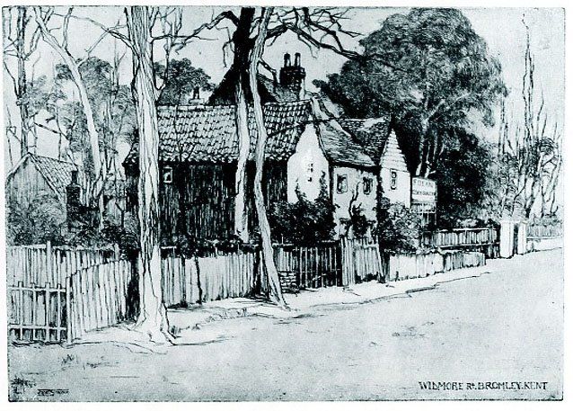
Born in 1839, David Goudie Simpson was living in Scotland by 1851 and presumably met his future wife there as they married in Edinburgh on 4th June 1867. The couple moved south and were living at 200 Camberwell Grove, Camberwell in 1881. The children, all born in Camberwell, were Mary Goudie (b.1868), David Chisholm (b.1870), Annie Goodie (b.1872), Janet, William Murray (b.1876) and Agnes Wardrop (b.1878). Janet and her parents (and probably some siblings) moved to 155 Widmore Road in Bromley in 1903. When built in 1887, the house was called Rosenfelds, later Rosenfeld, and numbered 62. When Widmore Road was renumbered in 1903, odd numbers to the north side, even numbers to the south side, it became number 155 and the family renamed it Rosefield. After Mr. Simpson died, around 1920, his widow continued to live there until 1925 together with Mary, Annie and Janet.
Although registered as an elector in Bromley, until at least 1910, David Goudie Simpson was also registered to a tenement at 325 Camberwell New Road.
Janet later moved to Crooke Cottage in the village of Brenchley, a few miles south of Paddock Wood, where she died on 8th April 1968, aged 94. Reportedly her time in the country was not undisturbed as, in 1944, an anti-aircraft battalion set up in a nearby field. Following test firings, the cottage lost most of its tiles and two ceilings collapsed. An apologetic group of soldiers moved on to Horsmondon the next day!
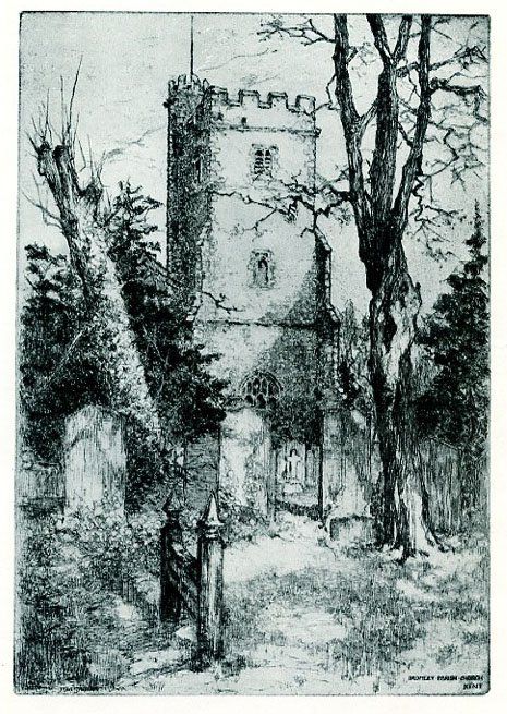
In ELS Horsburgh's Bromley it is reported that David Goudie Simpson gifted a carved oak font cover to the Parish Church in 1924, the work of Agnes Simpson which had a wrought iron cross to lift it, designed by David Chisholm FRIBA. This appears to be an error; it was almost certainly David Chisholm Simpson who moved to Bromley at the same time as the rest of the family, living first at 75 Crown Lane and from 1910 at Iona, 19 Wendover Road, until 1955. It seems likely the cover did not survive the destruction of the church in 1941.
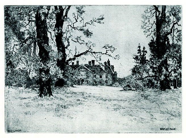
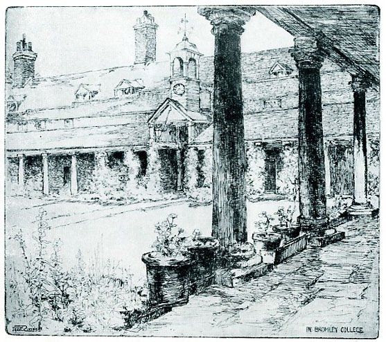
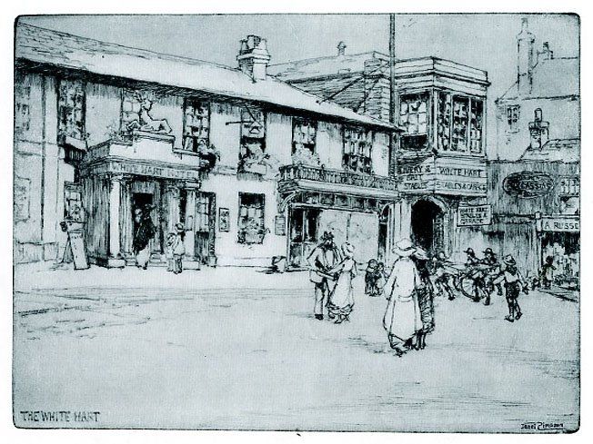
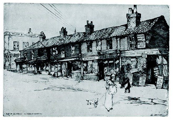
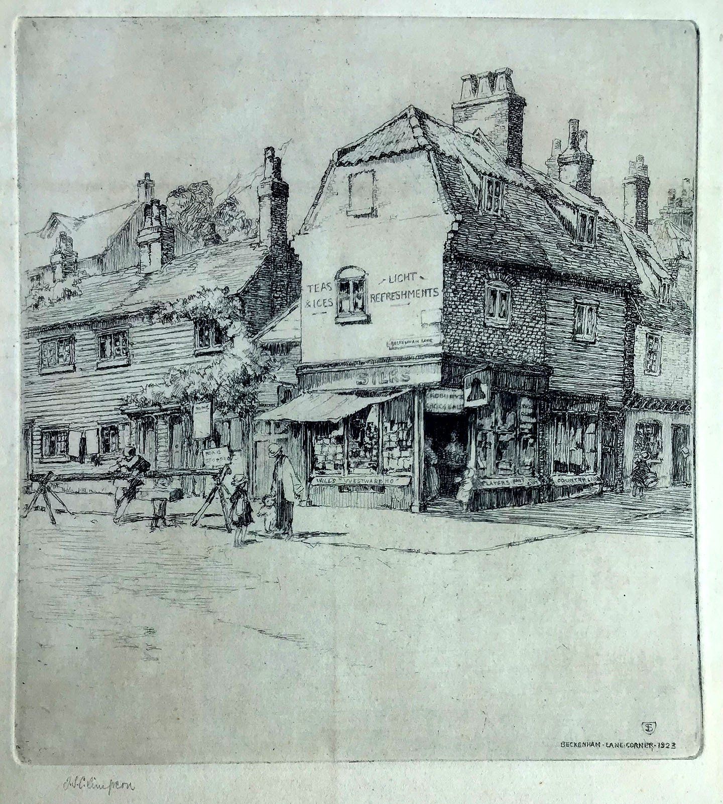
Although this collection of drawings was published in 1929 by which time Janet had left Bromley, mostly undated they appear to have been assembled from sketches made over the preceding 25 years. Whilst some locations are still recognisable today, others are more obscure and some have proved hard to identify accurately. If you have further information or can supply corrections, please use the I have a Comment page.
Our thanks to Jenny Mewis for the loan of her collection.
In May 2021 we were approached by Sue Jolly who lives in Somerset but whose grandfather, George Raymond Kirby, and great grandfather, George Edward Kirby, ran a watchmakers shop in East Street from 1880 until around 1957. Her great aunt Mildred had been a friend of Janet's and received various pictures of Bromley over the years. We are grateful to Sue for sending them to us - they are the last four in this collection.
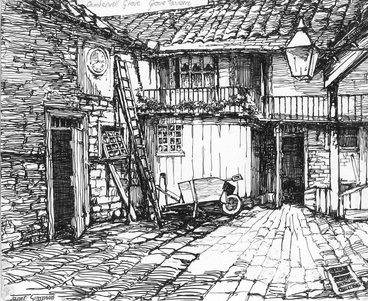
In 2026, we were contacted by Deborah Bacon who, while sorting through old family papers, found another Janet Simpson drawing, reproduced at the bottom. This may well be the oldest picture in this collection as Janet lived in Camberwell with her parents when one assumes this would have been drawn then. Although labelled Grove Tavern (there was one not far away), it is more likely the Grove House Tavern which was demolished c.1920 and replaced by the current building.
Click on any picture to see a larger image; you can then move forward or back using the arrows on the sides.